🚛🗺️ Geocoding for Logistics with Open Route API and Google Sheets
Categories
Created by
saSamir SaciLast edited 298 days ago
Tags: Supply Chain, Logistics, Geocoding, Transportation, GPS API
Context
Hi! I’m Samir — a Supply Chain Engineer and Data Scientist based in Paris, and founder of LogiGreen Consulting.
I help companies improve their logistics operations using data, AI, and automation to reduce costs and minimize environmental footprint.
Let’s use n8n to analyze geographical data!
📬 For business inquiries, you can add find me on LinkedIn
Who is this template for?
This workflow is designed for logistics and transport teams but also market analytics experts that need to process geocoding data (get GPS coordinates from addresses).
Ideal for:
- Transportation Planning
- Supply Chain Network Design
- Route optimization studies
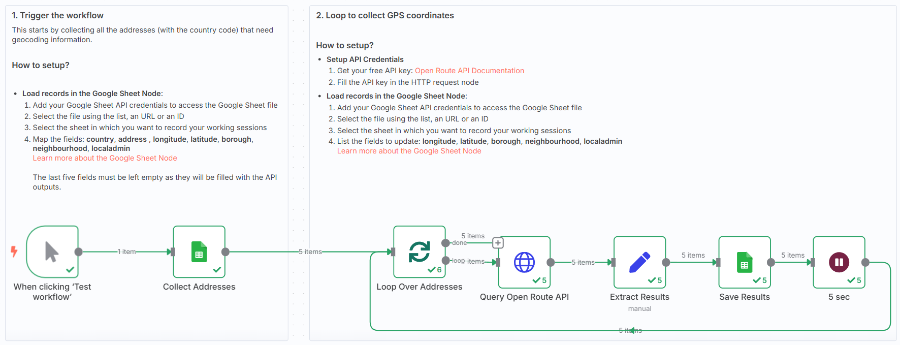
How does it work?
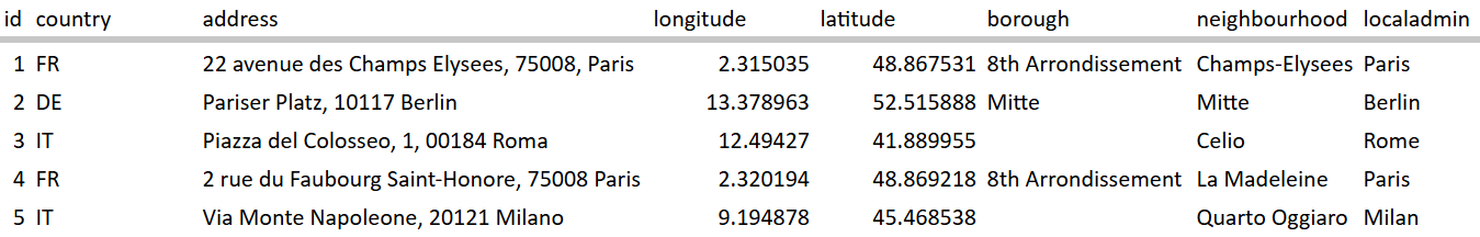
This n8n workflow connects to a Google Sheet where you store addresses with country codes, and uses the OpenRouteService API to calculate:
- 📏 GPS Coordinates (longitude, latitude)
- 🗺️ Neighbourhood, City and local information
Steps:
- ✅ Load addresses with country codes
- 🔁 Loop through each record
- 🚚 Query OpenRouteService
- 🧾 Extract and store results: longitude, latitude, neighbourhood
- 📤 Update the Google Sheet with new values
What do I need to get started?
This workflow is beginner-friendly and requires:
- A Google Sheet with route pairs (departure and destination coordinates)
- A free OpenRouteService API key
👉 Get one here
Next Steps
🗒️ Follow the sticky notes inside the workflow to:
- Select your sheet
- Plug in your API key
- Launch the flow!

🚀 You can customise the workflow to:
- Add additional outputs from the API
- Connect to your TMS via API or EDI
This template was built using n8n v1.93.0
Submitted: June 1, 2025
You may also like


New to n8n?
Need help building new n8n workflows? Process automation for you or your company will save you time and money, and it's completely free!


